In the picturesque Pollonia, at the NE end of Milos, is the starting point of this route.
From the beach, where the buses stop, follow the asphalt road that goes south / southeast, to Voudia. Say goodbye to the last houses of the settlement, pass by the football field, and just below you meet on your left, by the road, the chapel of Timiou Staurou .
Immediately after the chapel, enter the area of the S & B facilities and the mining areas.
Passing outside the gate of the premises, next to the offices, you take a southwesterly direction going uphill to the right. You have behind you a view of Kimolos and the uninhabited Polyaigos.
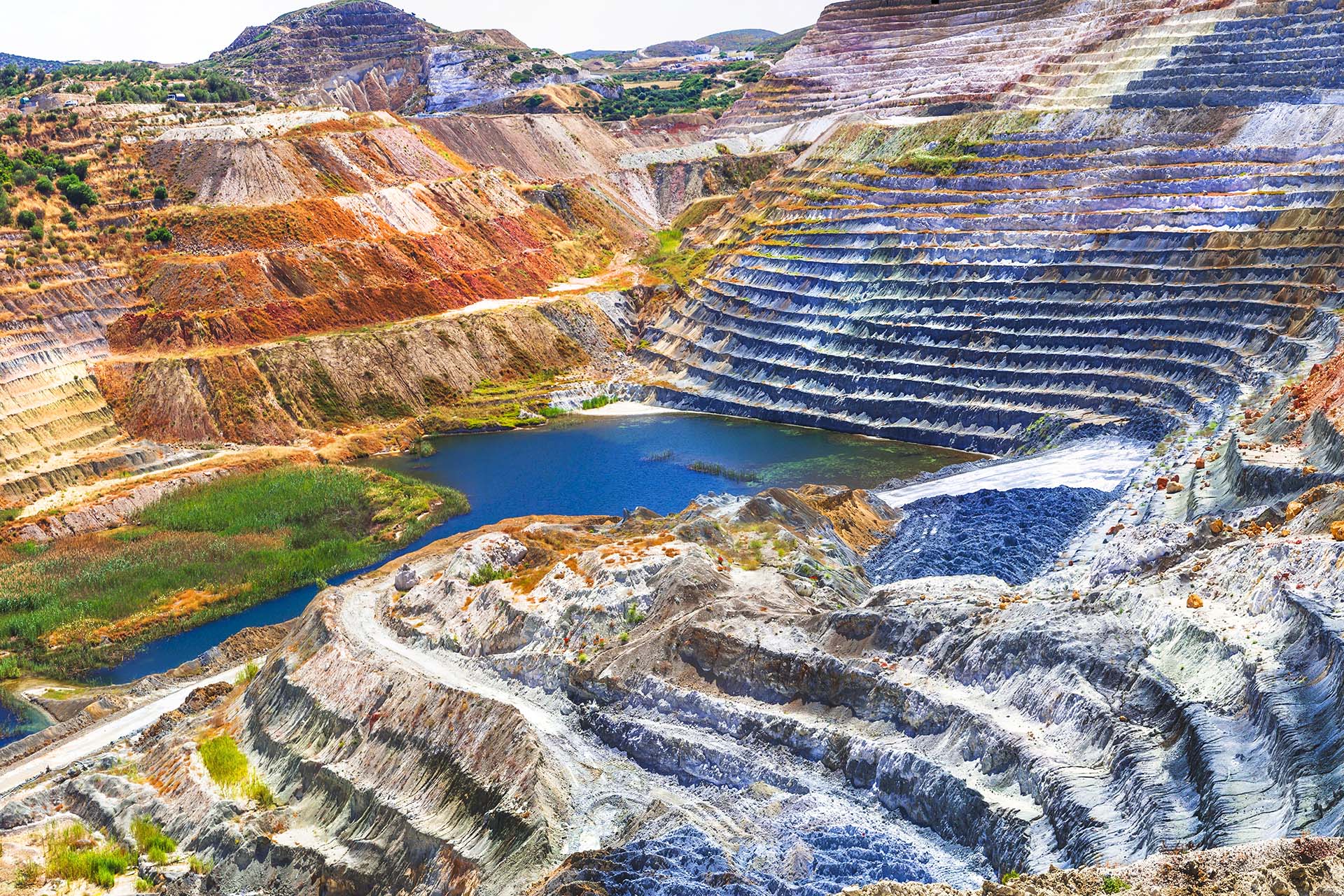
After about 1 km from the gate of the facility, you meet on your left the restored Tsantili bentonite mine , where the exploitation is over, the excavation has been completed and configured and the slopes have been planted.
Continuing, you reach two successive” forks “(junctions), where you both follow the road to the right, west, and enter the main dirt road of the mines to reach the large and impressive mine of Aggeria, which you can to see from the specially designed observation point. The geological formations from the surface down in the southern region are colorful and impressive.
From the observation point you turn 200 m backwards and turn left, on the dirt road that goes to the north, following the signs of Route 4. Just 80 m after the intersection you will see on your right the chapel of Agia Aikaterini. Heading now, to Pachaina on your left, you see another restored area, of the mining unit of Ag. Peace. To the right and left of the road, you meet clusters of cedars and then, scattered cedar people, you meet up to the Prison.
The Prison (P8) , a guarded archeological site, is one of the most important prehistoric settlements of the Cycladic civilization, which gave its name to a sub-period.
The main road, which descends to the northeast, now leads you to Pollonia


